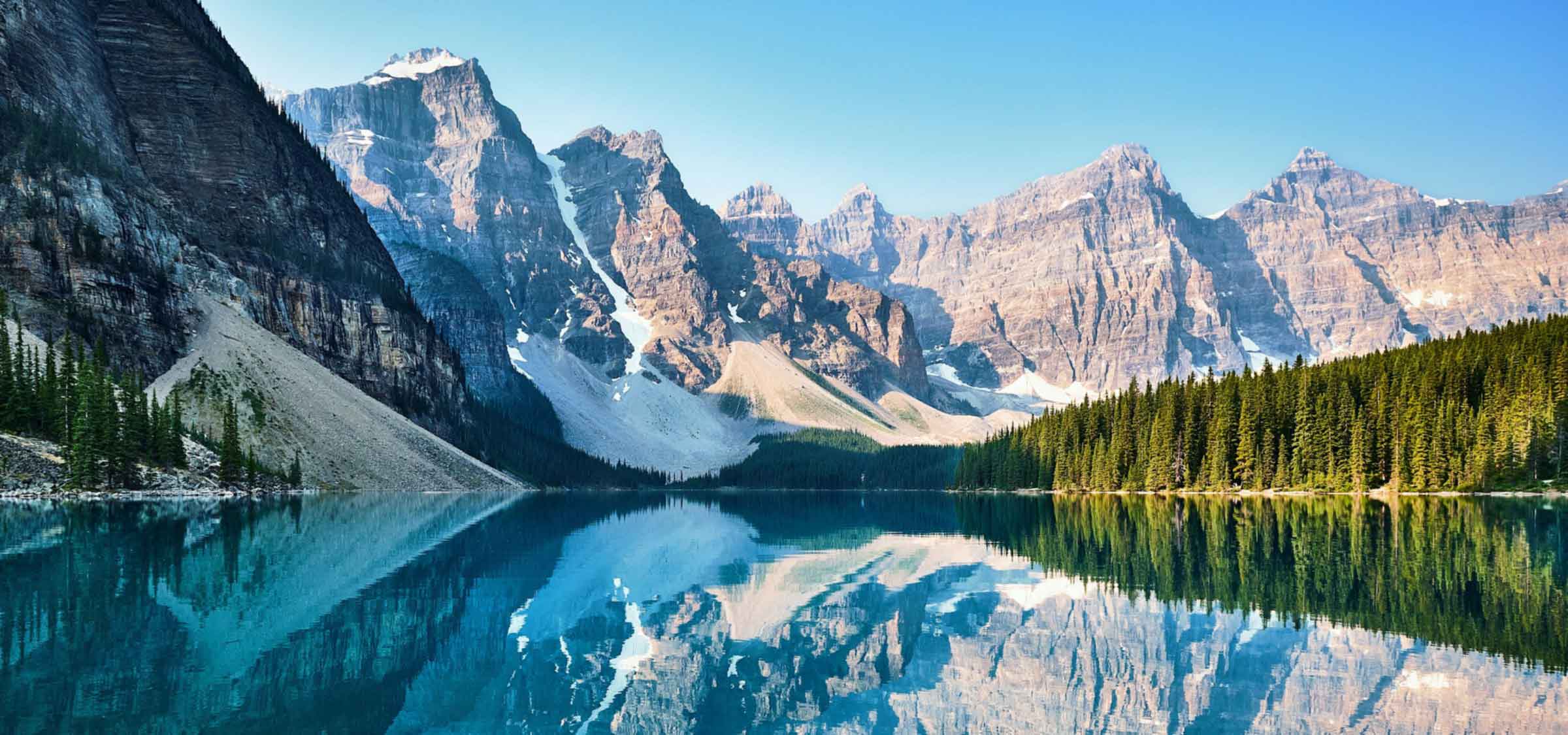
Clearwater, British Columbia, is a district municipality nestled in the North Thompson River valley. It's where the Clearwater River meets the North Thompson River, 124 km north of Kamloops. Established on December 3, 2007, Clearwater is one of the newest municipalities in British Columbia. It's located near Wells Gray Provincial Park and is surrounded by the Trophy Mountains, Raft Mountain, and Dunn Peak.
Before European settlement, the Okelhs First Nations occupied the area now known as Clearwater. They were eventually replaced by the Chilcotins in the 1870s. The fur trade brought the earliest settlers to the area. The Overlanders expedition to the Cariboo goldfields rafted down the North Thompson River in 1862. Upon reaching the mouth of the Clearwater River, they named it for its distinct clarity compared to the relatively muddy waters of the North Thompson. The Overlanders also named Raft Mountain, which rises northeast of Clearwater to a height of 2,450 m (8,038 ft).
Significant dates in Clearwater's history include:
Clearwater is 406 metres above sea level and is located in the North Thompson Valley in the Shuswap Highlands of the Interior Plateau. The Cariboo Mountains are located to the west and the Monashee Mountains to the east.
In the 2021 Census of Population conducted by Statistics Canada, Clearwater had a population of 2,388 living in 1,057 of its 1,145 total private dwellings, a change of 2.8% from its 2016 population of 2,324. With a land area of 55.65 km2 (21.49 sq mi), it had a population density of 42.9/km2 (111.1/sq mi) in 2021. The 2017 unemployment rate was 5.7%. The majority of residents are married or live common law. Nearly all residents speak English as their mother tongue, though a small proportion speak French.
Forestry was the principal industry in the area. There was one major mill in the area, in Vavenby, but that mill was closed permanently by Canfor in 2019 due to outdated equipment. There are several woodlot licenses within the area.
Local production includes beef, alfalfa, hay crops, and vegetables.
Clearwater gains international recognition through tourism. The town calls itself the "gateway to Wells Gray Provincial Park", as the main access to the park is through the town. The park houses a multitude of lakes and waterfalls, including several inactive and potentially active volcanoes. In 2012, the total number of tourism-based visitors was 578,445. In 2011, the estimated economic impact of tourism in Wells Gray Country was $21,513,261. Sports tourism is also a growth sector for the community.
Clearwater is close to the Ruddock Creek mine and the Harper Creek mine. The forest industry, tourism, and related outdoors and sports services are major industries in the area.
Clearwater is located on the Yellowhead Highway #5. Its closest major junctions are to the south (Highway 24 in Little Fort) and to the North (Yellowhead Highway #16), diverging between Prince George and Edmonton. Via Rail's The Canadian calls at the Clearwater station three times per week in each direction; this is a flag stop. The Canadian National Railway mainline runs through the town.
Scenic flights and fixed-wing air charter services are provided by Wells Gray Air from the Clearwater Airport. International and domestic scheduled air service is provided in Kamloops. Chartered helicopter service is also available.
For travel outside of the city, there is a community service bus provided by BC transit. With the closure of Greyhound Lines Canadian routes, there is no longer any commercial bus service to the town, though there are plans for this in the future. For travel within the town, there is scheduled bus service with limited ride times.